

The Deep-Time Foundation of Northeast Tennessee
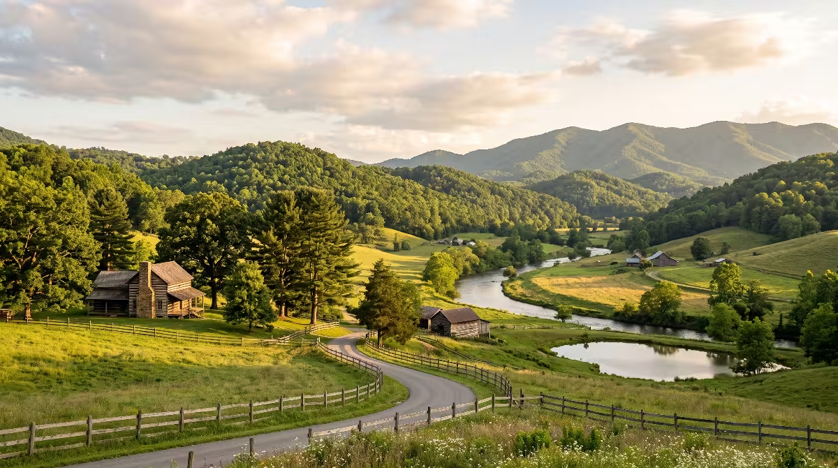
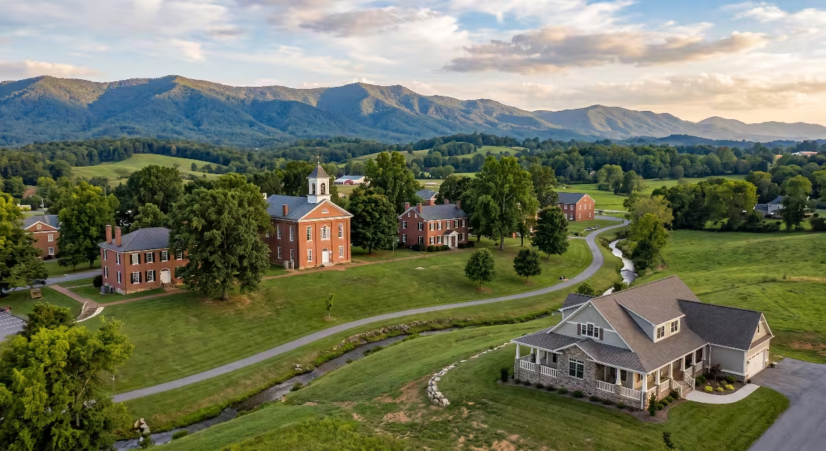
When you look out across the rolling hills of Johnson City, Kingsport, Bristol, or Elizabethton, you are seeing the result of hundreds of millions of years of earth history. Most of us think about our property in terms of property lines, lawn care, or the view from our back porch. However, the ground beneath your home has a deep story that shapes your daily life. The rock and soil beneath your feet dictate how your home settles, where your water comes from, and why certain hills rise sharply behind your neighborhood.
The
Every homeowner in this region lives with the direct results of this long history. The stability of your home foundation, the minerals in your well water, the drainage in your garden, and the slope of your driveway all connect back to three major geologic events: ancient marine deposition, massive mountain-building collisions, and steady river carving. When you understand the path of the Watauga River and the rock layers of the Holston basin, you can make smarter choices about home maintenance, site planning, and regional construction.
       GEOLOGICAL PROFILE OF THE REGION
       ================================
 [ Blue Ridge Mountains ] ----> High-energy headwaters of the Watauga River
             |                  (Precambrian / Cambrian hard crystalline rock)
             v
 [ Valley and Ridge ] --------> Thrust-faulted sedimentary strata
             |                  (Knox Group dolomite, Honaker limestone, Sevier shale)
             v
 [ Karst Drainage Network ] --> Underground caves, sinkholes, and springs
             |                  feeding into the main channel of the Watauga River
             v
 [ Fluvial Confluence ] ------> Watauga River joins South Fork Holston at Boone Lake
Paleozoic Marine Deposition: Laying the Carbonate Bedrock (540 to 300 Ma)
The Iapetus Ocean Shoreline
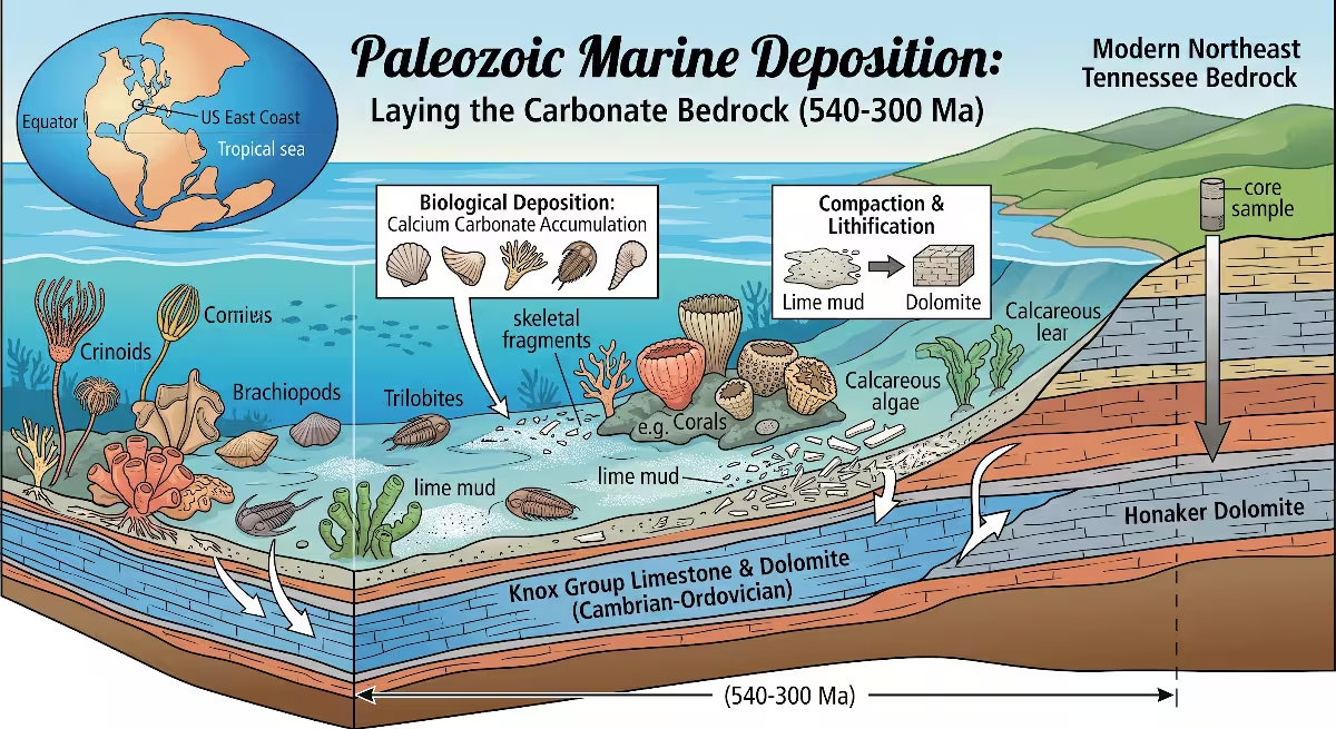
More than 500 million years ago, during the early Paleozoic Era, the land that is now Northeast Tennessee was not a mountain region at all. Instead, it was a shallow, warm ocean basin known to geologists as the Iapetus Ocean. This ancient ocean covered much of what is now the eastern United States. The region was located closer to the equator at that time, creating a tropical marine environment similar to the modern Bahamas.
In this shallow sea, trillions of tiny marine organisms lived, died, and settled to the sea floor. Their shells and skeletal structures were made of calcium carbonate. Layer upon layer of these shell fragments and lime mud accumulated over tens of millions of years. Under the heavy pressure of newer sediment layers, these deposits compressed into thick sheets of solid carbonate rock. This process created the massive limestone and dolomite units that define the lower Watauga River watershed and the greater Holston basin today.
The most famous of these rock units is the Knox Group. The Knox Group is a thick series of dolomite and limestone layers that underlies vast parts of Johnson City, Kingsport, and the Watauga River valley. Another major unit from this time is the Honaker Dolomite, which forms strong, dense bedrock layers across Carter and Sullivan counties. When you walk along the banks of the Watauga River near Elizabethton or along the South Fork Holston River, you can see these gray, weathered carbonate ledges exposed at the surface.
          ANCIENT IAPETUS OCEAN (500 Million Years Ago)
~~~~~~~~~~~~~~~~~~~~~~~~~~~~~~~~~~~~~~~~~~~~~~~~~~~~~~~~~~~~~~~~~ (Water Surface)
    [ Marine Organisms / Shells / Calcite Mud Accumulation ]
----------------------------------------------------------------- (Sea Floor)
  [ Layer 1: Lime Mud ]       --> Compresses into Knox Group Dolomite
  [ Layer 2: Silts & Mud ]    --> Compresses into Sevier Shale
  [ Layer 3: Quartz Sand ]    --> Compresses into Erwin / Chilhowee Sandstone
Chemical vs. Clastic Strata
Geologists divide the sedimentary rocks of the Watauga River basin into two major categories: chemical rocks and clastic rocks. Understanding the difference between these two rock types helps explain why our local land looks and behaves the way it does.
Chemical rocks form when minerals drop out of water solutions or when sea creatures build shells. Limestone and dolomite are the primary chemical rocks of the Watauga River watershed. Limestone consists mainly of calcium carbonate, while dolomite contains both calcium and magnesium carbonate. These rocks are strong and can hold heavy structural loads, but they are chemically vulnerable. Rainwater is naturally slightly acidic, and over time, it dissolves carbonate rock. This chemical weathering is the root cause of every cave, spring, and sinkhole near the Watauga River.
Clastic rocks form from physical pieces of older weathered rocks that were washed into water basins by ancient rivers. These include sandstones, siltstones, and shales. The Chilhowee Group and the Rome Formation are prime examples in the Watauga River area. Sandstones consist of hard quartz grains cemented together. Because quartz does not dissolve in acidic rainwater, sandstone layers resist chemical breakdown. Shales form from compressed clay and mud. They do not dissolve like limestone, but they can easily flake, crack, and slide when wet.
| Rock Classification | Primary Formations in Basin | Mineral Composition | Engineering Behavior | Common Landform |
| Chemical Carbonates | Knox Group, Honaker Dolomite | Calcite ($CaCO_3$), Dolomite ($CaMg(CO_3)_2$) | Soluble in water; creates sinkholes; high bearing strength when solid | Broad valleys, karst plains, river bluffs |
| Clastic Siliciclastics | Erwin Quartzite, Rome Formation | Quartz grains ($SiO_2$), feldspar, iron oxides | Highly resistant to chemical weathering; brittle fractures | High mountain ridges, steep gorges |
| Clastic Argillaceous | Sevier Shale, Nolichucky Shale | Illite, kaolinite, fine silt particles | Expansive clay potential; low shear strength on slopes | Low rolling ridges, soft hillsides |
Orogenic Collisions: Folding, Faulting, and Valley-and-Ridge Geometry
The Mountain-Building Trilogy
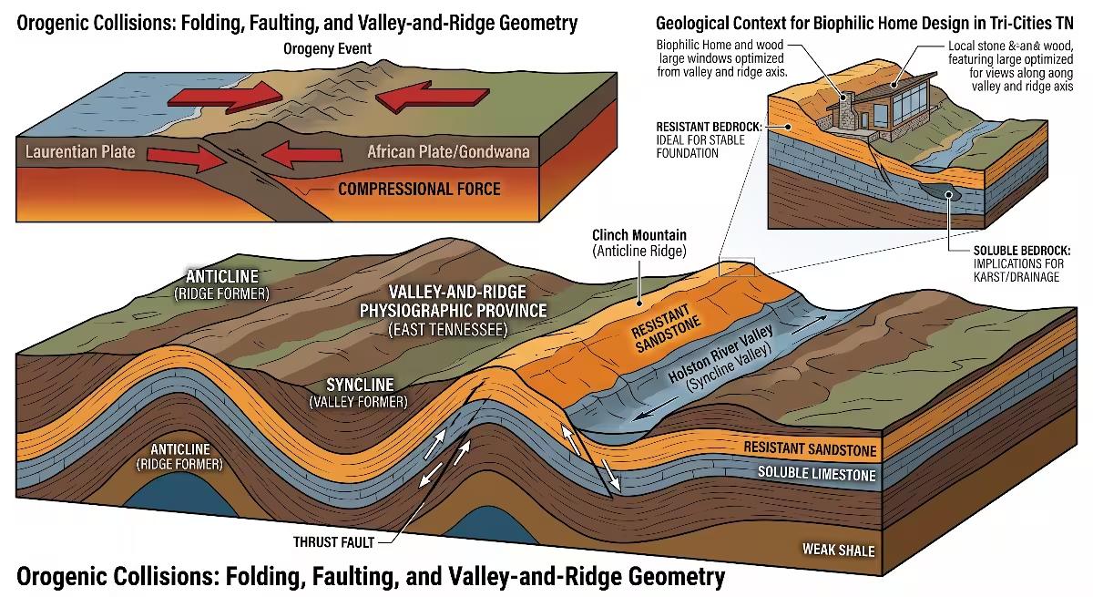
The flat layers of rock laid down in the ancient ocean did not stay flat. Over hundreds of millions of years, the eastern edge of North America experienced three massive tectonic collisions, known as orogenies. These collisions pushed ancient continents together and reshaped the landscape of the Watauga River region.
The first major event was the Taconic Orogeny during the Ordovician Period, roughly 450 million years ago. Volcanic island chains collided with North America, warping the sea floor and dumping thick layers of mud and silt into the basin. This mud later hardened into the Sevier Shale, a common rock unit found around the Watauga River and Holston River drainages.
The second event was the Acadian Orogeny during the Devonian Period, about 375 million years ago. A small continental landmass collided with North America, adding more heat, pressure, and sediment to the region.
The final and most powerful event was the Alleghanian Orogeny, which occurred between 325 and 260 million years ago. The supercontinent of Gondwana (including modern Africa) slammed directly into North America to assemble the supercontinent of Pangea. The pressure from this collision was immense. It compressed the rock layers from southeast to northwest, squeezing thousands of feet of flat marine rock into huge folds and fractures.
This collision created the ancestral Appalachian Mountains, which once stood as tall as the modern Himalayas.
       ALLEGHANIAN TECTONIC COMPRESSION (280 Million Years Ago)
========================================================================
 Direction of Force: [ Southeast ] ====================> [ Northwest ]

 (Blue Ridge Basement)      (Thrust Fault)       (Valley & Ridge Sediments)
       /\     /\                  /                   /\        /\
      /  \   /  \                /                   /  \______/  \
     /    \_/    \  ==========> /                   /   Syncline   \
    / Crystalline \            /                   /   (Valleys)    \
   /  Rock Sheets  \          / (Pulaski Fault)   / Anticline (Ridges\
Structural Mechanics of the Tri-Cities Region
The Alleghanian collision created the distinct landscape we call the Valley and Ridge Province. When you travel across the Watauga River basin, you will notice a repeating pattern: long, narrow ridges running from northeast to southwest, separated by wide, parallel valleys.
This pattern is the direct result of thrust faults and differential weathering. During the mountain building, the rock layers did not just bend; they cracked and slid along massive break lines called thrust faults. The Iron Mountain Fault and the Pulaski Fault are two of the largest fault lines crossing the Watauga River region. These faults pushed older, deeper rock layers up and over younger rocks.
Once the mountain building stopped, millions of years of rain and weather went to work. The soft, soluble limestone and dolomite dissolved away, forming the low valleys where the Watauga River and Holston River flow today. The hard, chemically resistant quartzites and sandstones did not dissolve. They remained standing high as the ridges, such as Holston Mountain, Buffalo Mountain, and Iron Mountain. When you look up at the ridge lines from the Watauga River, you are looking at the durable skeleton of the ancient mountain chain.
Fluvial Evolution: How Ancient Drainages Incised Modern Terrain
Superimposed vs. Structurally Controlled Drainage
Rivers are the primary sculptors of the modern East Tennessee landscape. The Watauga River is an exceptional example of an ancient drainage system that has adapted to changing rock structures over tens of millions of years.
Hydrologists and geologists classify river patterns based on how they interact with underlying rock. In some areas, the Watauga River follows structurally controlled drainage. This means the river takes the path of least resistance, flowing along soft limestone beds parallel to the ridges. In these stretches, the Watauga River stays within the broad valleys, meandering gently across flat land.
However, in other places, the Watauga River cuts straight through hard sandstone and quartzite ridges, creating deep, dramatic gorges. The Watauga River Gorge near the state line is a premier example. This happens because the river is older than the modern surface topography. As the ancient Appalachian plateau was slowly lifted up by deep earth forces during the Cenozoic Era, the Watauga River was already flowing. The river possessed enough water volume and cutting power to slice downward through rising rock layers. Geologists call this a superimposed drainage pattern. The Watauga River carved its canyon right through the hard rock instead of being redirected around it.
                  RIVER INCISION OVER TIME
============================================================
 Stage 1 (Ancient): River flows on top of a flat, high plain
 ~~~~~~~~~~ Watauga River Flow ~~~~~~~~~~
 [ Flat Sedimentary Layer A             ]
 [ Hard Sandstone / Quartzite Layer B   ]
 [ Soft Carbonate Layer C               ]

 Stage 2 (Modern): Deep downcutting reveals different rock types
                   |  Watauga River Gorge  |
                   |       \     /         |
  High Ridge       |        \ ~ /          |        High Ridge
  [ Layer B ]      |         \_/           |        [ Layer B ]
                   |                       |
                   |   Carbonate Valley    |
                   |   [ Layer C Bedrock ] |
Fluvial Terraces and Alluvial Soils
As the Watauga River cut deeper into the earth over millions of years, it left behind ancient riverbanks at higher elevations. These step-like flat areas are called fluvial terraces.
If your home sits on a flat bench a few hundred feet above the modern Watauga River, you may actually be living on an ancient riverbed. These terraces contain rounded river gravel, smooth quartz cobbles, and thick layers of river-deposited silt, known as alluvium.
Alluvial soils along the Watauga River are typically deep, fertile, and easy to dig. However, they differ greatly from the residual soils found on nearby hillsides. Residual soils form directly from the breakdown of the bedrock beneath them. Residual limestone soils in the Watauga River basin are usually rich in heavy red and yellow clay. These clay soils drain slowly and expand when wet. Alluvial soils closer to the Watauga River contain more sand, silt, and rounded stones, which allows water to filter through much faster. Knowing whether your property sits on river alluvium or residual limestone clay is essential for planning home gardens, driveways, and foundation footings.
Karst Hydrogeology: Caves, Underground Drainages, and Sinkholes
Carbonate Dissolution Mechanics
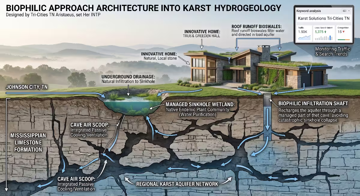
The dominant geological process shaping daily life in the Watauga River basin is karst formation. Karst is the scientific term for a landscape formed by dissolving soluble rocks like limestone and dolomite.
The process starts in the sky. As rain falls through the atmosphere, it absorbs tiny amounts of carbon dioxide. When this rainwater filters down through topsoil and decaying leaves, it picks up even more carbon dioxide. This turns the water into a very weak acid called carbonic acid (H2CO3).
                 HOW SINKHOLES AND CAVES FORM
==============================================================
 Rainwater + Soil Carbon Dioxide ===> Weak Carbonic Acid (H2CO3)
                                            |
                                            v
 Percolates into fractures in Knox Group Dolomite / Limestone
                                            |
                                            v
 Acid dissolves Calcium Carbonate: CaCO3 + H2CO3 ===> Ca(HCO3)2
                                            |
                                            v
 Underground cracks widen ===> Conduits ===> Caves ===> Sinkhole Collapse
When this acidic water seeps into the ground across the Watauga River valley, it encounters the Knox Group and Honaker Dolomite. The acid reacts with the calcium carbonate (CaCO3) in the rock, slowly dissolving it into soluble calcium and bicarbonate ions.
Water moves along natural hairline cracks, bedding planes, and fault lines in the rock. Over thousands of years, these tiny cracks widen into open pipes, underground channels, and large cave chambers. Eventually, the solid rock beneath the soil becomes a network of natural plumbing pipes.
Regional Hydrogeological Features
Because of this dissolving process, the land surrounding the Watauga River is filled with world-class cave systems and karst features. Commercial caves like Bristol Caverns and Appalachian Caverns show this underground world in stunning detail. Inside these caverns, visitors can see vast rooms, underground streams, and mineral formations that have grown drip by drip over millennia.
In an active karst landscape, surface water does not always stay on the surface. In many parts of the Watauga River watershed, small streams will flow along the surface for a short distance, hit a limestone fracture, and disappear completely underground. These are called sinking creeks or disappearing streams.
This underground water travels through hidden gravel beds and open rock conduits before bubbling back up to the surface at large karst springs. Many of these natural springs discharge cold, clear, mineral-rich water directly into the Watauga River, keeping the river cool and clean even in the hot summer months.
                  TYPICAL KARST FLOW PATTERN
==============================================================
 [ Rainfall on Ground Surface ]
              |
              +---> Drops into Surface Sinkhole
              |
              v
 [ Underground Conduit / Cave System ] (Rapid flow, no filtration)
              |
              v
 [ Subterranean Stream ]
              |
              v
 [ Natural Karst Spring ] ------------> Discharges into Watauga River
Late Miocene and Early Pliocene Preservation: The Gray Fossil Site
One of the most remarkable examples of karst geology in the world sits just a few miles from the Watauga River in Washington County: the Gray Fossil Site.
About 4.5 to 7 million years ago, during the late Miocene to early Pliocene epochs, an enormous sinkhole opened up in the Knox Group dolomite near what is now the town of Gray. The bottom of the sinkhole reached down to the water table, creating a deep, calm pond surrounded by lush forest.
Over hundreds of years, animals came to the pond to drink. Some died along the banks, and their bones sank into the fine, oxygen-poor mud at the bottom of the sinkhole. The sinkhole acted as a natural preservation vault.
When highway workers accidentally unearthed the site in 2000, paleontologists discovered an extinct ecosystem. The site has yielded the remains of ancient tapirs, saber-toothed cats, mastodons, alligators, short-faced bears, and the world’s most complete fossil of an ancient red panda (Pristinailurus bristoli).
The Gray Fossil Site proves that the karst processes we see along the Watauga River today have been shaping animal life, plant communities, and landforms in Northeast Tennessee for millions of years.
Practical Guide for Property Owners: Engineering, Foundations, and Water Systems
Foundation Engineering on Karst
Building a home in the Watauga River basin requires an understanding of what lies beneath the topsoil. Because the underlying rock is limestone and dolomite, the top of the bedrock is rarely flat. Instead, it forms an underground landscape of sharp rock pinnacles, deep soil-filled slots, and hollow voids.
When planning to build near the Watauga River or on the surrounding karst plains, a standard visual inspection of the surface is not enough. Homeowners and builders should look for telltale signs of karst activity:
- Small, bowl-shaped depressions in the yard or adjacent fields.
- Trees or fence posts leaning toward a central low spot.
- Sudden cracks in driveways, foundation walls, or interior drywall.
- Areas where rainwater drains instantly underground without forming puddles.
               BEDROCK PINNACLES AND SOIL VOIDS
==============================================================
 [ Topsoil & Lawn ]
 ~~~~~~~~~~~~~~~~~~~~~~~~~~~~~~~~~~~~~~~~~~~~~~~~~~~~~~~~~~~~~
 [ Residual Clay Soil ]          [ Soil Cavity / Potential Sinkhole ]
       |                                |
       v                                v
    /\      /\      /\             (Hidden Void)
   /  \    /  \    /  \                 |
  /    \  /    \  /    \      /\        v
 / Rock \/ Rock \/ Rock \____/  \______/ \__ (Irregular Bedrock)
 [ Knox Group Dolomite / Limestone Bedrock ]
On sites with suspected karst activity, geotechnical engineers use soil borings or electrical resistivity testing to map the solid rock profile. If a foundation footing rests halfway on a solid limestone pinnacle and halfway on soft clay, the house can settle unevenly. This is called differential settlement.
To prevent problems, foundation footings may need to be reinforced with steel, deepened to rest directly on solid rock, or supported by micro-piles driven into sound limestone.
Surface water management is the most important factor in preventing sinkholes on residential property. Concentrating roof runoff from downspouts or directing driveway water toward a single unlined ditch can wash soil down into underlying rock fractures, triggering a sinkhole collapse. Water should always be spread out over broad, vegetated areas or piped safely away from foundation zones.
Private Water Well Siting
Many residents in the rural areas of the Watauga River watershed rely on private groundwater wells for their household drinking water. Siting and drilling a well in carbonate rock is very different from drilling in areas with thick sand aquifers.
In the limestone and dolomite layers around the Watauga River, solid rock has very little pore space. Water does not soak through the rock like a sponge. Instead, groundwater travels almost entirely through open fractures, faults, and dissolved channels.
                     WELL WATER DRILLING PROFILES
========================================================================
            Well A (Dry / Low Yield)         Well B (High Yield)
                    |                                |
                    v                                v
 [ Soil Layer ]     |                                |
 -------------------|--------------------------------|------------------
 [ Bedrock ]        |                                |
                    | (Solid rock,                   | (Hits fracture)
                    |  no fractures)                 |==== Water Flow ===
                    |                                |
                    x (Low Water Yield)              v (High Water Yield)
This structural reality creates unique challenges:
- Hit-or-Miss Water Yields: If a well drill bit misses a fracture by only ten feet, the well may produce less than two gallons per minute. If it strikes an open, water-filled fracture, the well can yield over fifty gallons per minute. Professional well drillers in the Watauga River area often look for natural fault lines and rock fracture patterns to pick the best drilling spot.
- Rapid Contamination Risks: In sandy soils, water filters slowly through sand grains, cleaning out bacteria and impurities. In the karst networks of the Watauga River basin, water moves quickly through open conduits without natural filtration. Surface pollutants, livestock runoff, or failing septic tanks miles away can enter a sinkhole and reach a drinking well in a matter of hours.
- Hard Water Mineralization: Because local groundwater spends centuries in contact with limestone and dolomite, well water in the Watauga River basin is naturally hard. It contains high concentrations of dissolved calcium and magnesium ions ($Ca^{2+}$ and $Mg^{2+}$). While safe to drink, this mineral content creates scale buildup inside water heaters, pipes, and household appliances, making water softeners a standard necessity for local homes.
Bedrock Load-Bearing Capacity and Soil Mechanics
When building homes, retaining walls, or outbuildings near the Watauga River, property owners must understand the mechanical behavior of local soils and rock layers.
The load-bearing capacity of solid, unweathered Knox Group dolomite or Honaker limestone is exceptionally high, often exceeding 10,000 to 20,000 pounds per square foot. However, the clay soil resting directly on top of that rock has very different properties.
The red clay soils of the Watauga River basin are rich in secondary clay minerals derived from the weathering of limestone and shale. These soils have high plasticity, meaning they become sticky and soft when wet and shrink and crack when dry.
During heavy rainy seasons in East Tennessee, saturated clay soils lose significant shear strength. If a home is built on a steep slope overlooking the Watauga River where shale or clay beds tilt in the same direction as the hillside, the risk of soil slippage increases. Proper hillside grading, retaining wall drainage, and foundation anchoring are essential for long-term stability.
             SLOPE STABILITY AND DOWNDIP SLIPPAGE
==============================================================
 Rainfall Infiltration =====>
                             \
  [ Home Structure ]          \
       |                       \
   +-------+                    v
   | House |            [ Wet, Saturated Clay ]
   +-------+                    |
       |                        v
  ==================> [ Potential Slip Plane ]
  /////////////////////////////////////////// (Tilted Shale Layer)
  ///////////////////////////////////////////
  [ Stable Underlying Bedrock ]
Radon Potential and Indoor Air Quality
Radon is an invisible, odorless, radioactive gas that occurs naturally in soil and rock across the Watauga River region. It forms from the natural radioactive decay of trace amounts of uranium found in ancient marine shales, granites, and carbonate rocks.
The geological structure of the Watauga River basin creates an environment where radon moves easily into homes. The complex network of underground fractures, thrust faults, and karst channels acts like a series of chimneys that allow radon gas to rise toward the surface. When a home is built over these rock fractures, the home acts as a vacuum. Differences in air pressure draw radon gas inside through foundation cracks, sump pits, and gaps around plumbing pipes.
The Environmental Protection Agency (EPA) classifies most counties in the Watauga River basin, including Carter, Washington, and Sullivan counties, as Zone 1 areas. Zone 1 represents the highest risk tier, where homes have an average indoor radon screening level greater than 4.0 picocuries per liter (pCi/L).
Every resident in the Watauga River basin should test their home for radon. If levels exceed 4.0 pCi/L, installing an active sub-slab depressurization system is a straightforward fix. These systems use a dedicated pipe and small fan to draw radon gas from beneath the foundation slab and vent it safely outside above the roofline.
Biophilic Design and Vernacular Architecture: Integrating Local Geology
Material Authenticity and Local Stone
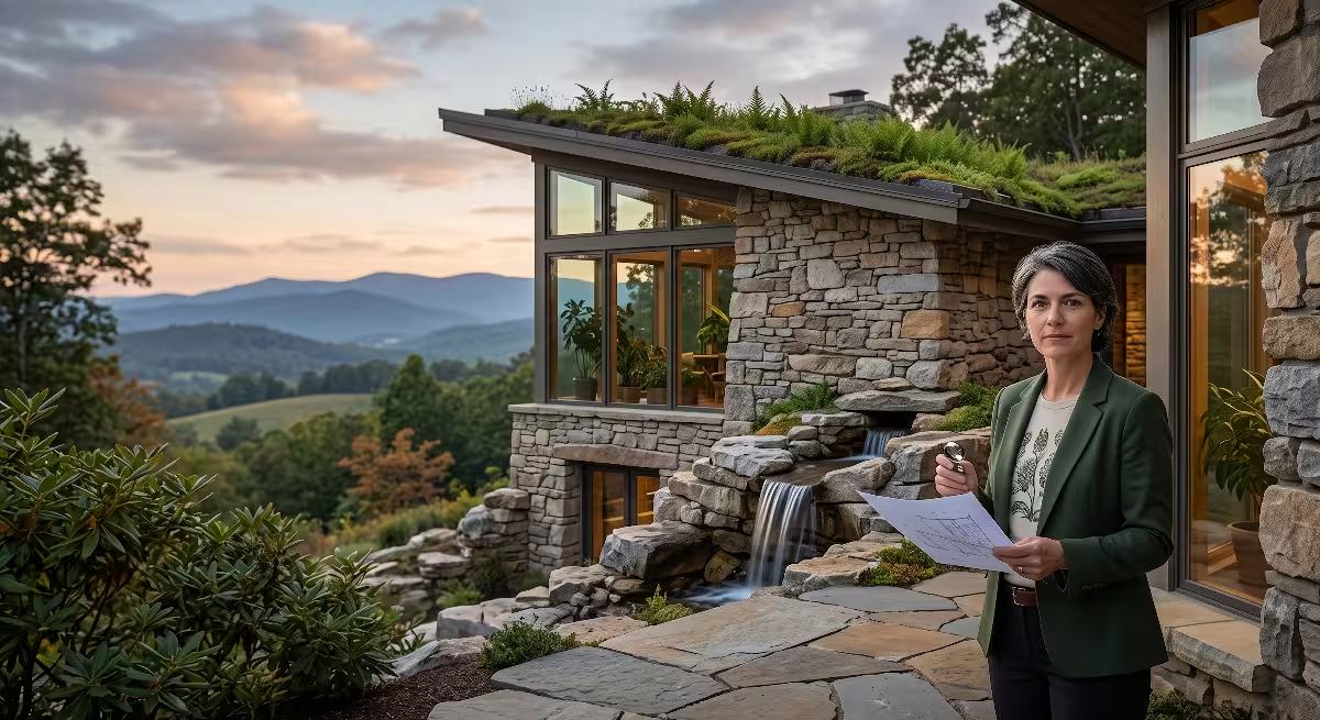
Biophilic design is the practice of connecting modern buildings and living spaces to the natural world. In the Watauga River valley, the most authentic way to practice biophilic design is to build with materials that come directly from our regional geology.
Using native stone creates an immediate visual and physical connection to the landscape of the Watauga River.
- Holston Limestone (Tennessee Marble): Known for its soft pink, gray, and cedar-tan tones, this dense limestone takes a smooth polish and works beautifully for indoor hearths, kitchen islands, and exterior accent walls.
- Watauga River Rock: Smooth, rounded quartz, sandstone, and river-washed cobbles gathered from historical floodplain terraces provide an organic, water-carved texture for garden borders, outdoor showers, and foundation facings.
- Iron Mountain Sandstone: Rough-cut, iron-stained golden brown sandstone blocks bring the rugged look of the high ridges right to your outdoor patios, retaining walls, and fireplaces.
       BIOPHILIC MATERIAL PALETTE (WATAUGA BASIN)
==============================================================
 [ Interior Living Spaces ]  <---> Smooth Holston Limestone Hearths
 [ Structural Foundation ]   <---> Local Dolomite Ashlar Masonry
 [ Transition Zones ]        <---> Flagstone Walkways & Native Stone Patios
 [ Landscape Boundaries ]    <---> Watauga River Cobble Drainage Swales
Using local stone is also environmentally responsible. Transporting heavy stone across the country burns significant fossil fuel. Sourcing stone from regional quarries within the Watauga River watershed keeps construction supply chains short, reduces project carbon footprints, and supports local stonemasons who understand how to work with regional rock.
Microclimate Alignment and Thermal Mass
The folded topography of the Watauga River basin creates distinct microclimates across very short distances. A building site located in a low valley along the Watauga River will experience colder morning temperatures, higher humidity, and river fog. A site located on a south-facing hillside above the river will receive intense afternoon sun and prevailing breezes.
Smart biophilic architecture works with these geological conditions rather than fighting against them:
Thermal Mass Utilization: Dense native stone and concrete floors have high thermal mass. When placed where winter sunlight can strike them, these stone elements absorb heat throughout the day and slowly radiate warmth back into the home at night. This mimics the way natural limestone bluffs along the Watauga River retain solar heat.Passive Solar Orientation : Orienting homes along the east-to-west axis allows builders to maximize natural light along the southern exposure while shielding living areas from harsh winter winds that sweep down off the mountain ridges.- Earth-Sheltered Construction: Taking advantage of natural hillside slopes in the Watauga River valley allows homes to nestle into the earth. The constant temperature of the surrounding soil (around 55 to 58 degrees Fahrenheit year-round in East Tennessee) provides natural insulation, cutting heating and cooling energy use significantly.
          PASSIVE SOLAR AND THERMAL MASS DESIGN
==============================================================
 Low Winter Sun Angle ===> Passes through South-Facing Windows
                             |
                             v
 [ Thick Native Limestone Flooring / Thermal Mass Wall ]
                             |
                             v
 (Absorbs heat by day ---> Releases radiant warmth at night)
Landscape Connectivity and Native Plant Communities
A truly biophilic home does not end at the exterior walls. It flows outward into a landscape that respects local soil chemistry and native ecology. The soils of the Watauga River basin vary widely based on their parent bedrock, and choosing plants that match your soil is key to creating a healthy yard.
Because much of the Watauga River valley is underlain by limestone and dolomite, the soils are naturally alkaline to neutral (pH 6.5 to 7.5) and rich in calcium. These conditions support calciphile (lime-loving) plant species that have adapted to our valley ecosystems for thousands of years.
| Landscape Zone | Soil & Geology Type | Recommended Native Plant Species | Ecological & Biophilic Function |
| Riverbank & Riparian | Wet, sandy alluvial silt near Watauga River | Sycamore (Platanus occidentalis), River Birch (Betula nigra), Silky Dogwood (Cornus amomum) | Stabilizes riverbanks, filters runoff water, prevents erosion |
| Karst Valley & Lawns | Deep, alkaline red clay over Knox Dolomite | Chinquapin Oak (Quercus muehlenbergii), Eastern Redbud (Cercis canadensis), Purple Coneflower (Echinacea purpurea) | Thrives in high-calcium soils; attracts native pollinators |
| Sandstone Ridges | Thin, acidic, well-drained quartz sandy loam | Chestnut Oak (Quercus montana), Mountain Laurel (Kalmia latifolia), Sourwood (Oxydendron arboreum) | Controls hillside erosion; provides vivid autumn foliage |
| Shaded Limestone Slopes | Moist, rich organic loam over limestone bluffs | Maidenhair Fern (Adiantum pedatum), Wild Columbine (Aquilegia canadensis), Virginia Bluebells (Mertensia virginica) | Creates cooling woodland textures; softens vertical stone walls |
By selecting native plants suited to the underlying geology of your Watauga River property, you eliminate the need for synthetic chemical fertilizers, reduce supplemental watering, and build a
Frequently Asked Questions About the Holston and Watauga Rivers for Basin Residents
How old are the Holston and Watauga Rivers?
The modern channels of the Holston River and Watauga River began cutting their current pathways between 60 and 100 million years ago, during the late Mesozoic and early Cenozoic eras. However, the rocks that these rivers flow across are vastly older. The limestones, dolomites, and sandstones of the Watauga River basin formed between 300 and 540 million years ago during the Paleozoic Era. The rivers have spent tens of millions of years patiently slicing through these ancient marine deposits.
Why are sinkholes so common in the Tri-Cities area?
Sinkholes are widespread throughout the Tri-Cities because the region is built on top of thick layers of soluble carbonate rock, specifically the Knox Group and Honaker Dolomite. Rainwater absorbs carbon dioxide as it passes through air and soil, forming a weak carbonic acid. Over thousands of years, this acidic water dissolves underground fractures in the rock, creating empty voids. When the soil above these underground voids becomes too heavy or washes downward into the rock, the ground collapses, forming a sinkhole. The entire Watauga River valley is part of this active karst landscape.
How does local geology affect home construction in East Tennessee?
Local geology affects residential construction in four major ways:
- Uneven Bedrock: The top of the limestone rock beneath the soil forms sharp pinnacles and deep clay pockets, requiring geotechnical soil checks to avoid cracked foundations.
- Expansive Clay Soils: Residual soils derived from weathered limestone have high clay content, which swells when wet and shrinks when dry.
- Sinkhole Development: Concentrated roof and driveway water runoff can trigger ground collapses if not managed properly.
- Radon Gas: Natural radioactive decay in regional bedrock and shale releases radon gas, which rises through rock fractures and requires sub-slab ventilation systems in homes.
Where do the Holston and Watauga Rivers converge?
The Watauga River meets the South Fork Holston River at Boone Lake. Boone Lake is a large reservoir created by the Tennessee Valley Authority (TVA) in the early 1950s when Boone Dam was constructed. The confluence is located right in the center of the Tri-Cities area, bordered by Johnson City, Kingsport, Blountville, and Piney Flats. The combined waters then flow downstream past Kingsport to join the North Fork Holston River, forming the main stem of the Tennessee River farther west.
The Interconnected Basin
Living in the Watauga River watershed means being part of a living geological system. The mountains framing your horizon, the rich red clay in your garden, the cool water flowing in our streams, and the rock beneath your home foundation are all connected parts of an ongoing earth story.
                  THE INTERCONNECTED BASIN CYCLE
==================================================================
 [ 500 Ma Marine Deposition ]  ===> Creates Knox Group Carbonate Bedrock
               |
               v
 [ 300 Ma Tectonic Collision ] ===> Folds Strata into Valley & Ridge Topography
               |
               v
 [ Continuous Fluvial Incision] ===> Watauga River Carves Modern River Valleys
               |
               v
 [ Modern Karst & Weathering ] ===> Forms Aquifers, Springs, Soils, and Sinkholes
               |
               v
 [ Biophilic Human Habitat ]   ===> Resilient Homes Built in Harmony with Nature
When you understand the deep-time history of the Watauga River basin, you can make informed choices as a homeowner and community member. You can build foundations that respect karst rock, manage stormwater to protect our groundwater, choose native stones and plants that celebrate our regional identity, and preserve the clean water of the Watauga River for generations to come. Northeast Tennessee is defined by its remarkable geology, and designing our homes in harmony with that geology is the foundation of enduring living.
Homeowner Subsurface Planning Checklist
To help you apply this geological knowledge to your own property, use this quick checklist when buying, planning, or improving a home site in the Watauga River basin:
- Site Drainage & Runoff: Ensure all gutters and downspouts discharge water away from foundation footings and do not drain directly into surface depressions or unlined ditches.
- Soil & Foundation Testing: For new construction, request a geotechnical soil boring test to identify the depth and shape of the underlying limestone bedrock.
- Radon Testing: Conduct a 48-hour continuous radon test on the lowest livable level of your home, and install an active mitigation system if levels exceed 4.0 pCi/L.
- Well Water Quality: If you use private well water, test annually for bacterial contaminants and install a water softening system to manage natural calcium and magnesium hardness.
- Biophilic Landscape Selection: Test your soil pH and select native plants, such as Eastern Redbud, Chinquapin Oak, or native ferns, that naturally thrive in high-calcium, limestone-derived soils.