

Introduction and Historical Foundations of the Tweetsie Trail
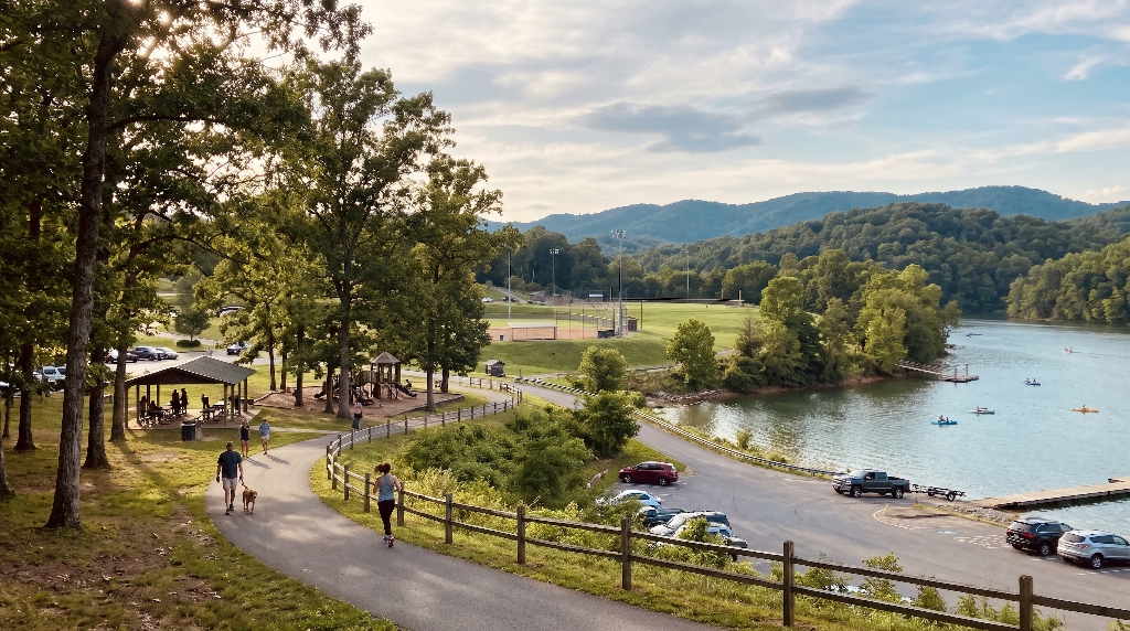
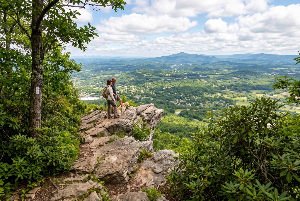
When you build a home in East Tennessee, you quickly learn that true luxury is not just about square footage or quartz countertops. True luxury is having immediate access to nature right outside your front door. The Tweetsie Trail stands as one of the finest examples of community vision, outdoor recreation, and historic preservation in our entire region. Stretching gracefully from downtown Johnson City into the historic heart of Elizabethton, this beloved greenway offers an escape for runners, cyclists, weekend walkers, and families with strollers.
The story of the Tweetsie Trail began generations ago with the East Tennessee and Western North Carolina Railroad. Locals affectionately called the old steam train “Tweetsie” because of the shrill whistle that echoed through the Blue Ridge valleys and mountain gorges. For decades, this
Today, the Tweetsie Trail serves as a regional connector between Washington County and Carter County. It bridges the gap between active urban life and peaceful countryside. It is rare to find a flat, safe, car-free corridor in a region defined by steep hills and rocky ridges. The Tweetsie Trail gives our community a shared front porch where neighbors meet, children learn to ride bikes, and visitors experience the natural beauty of Northeast Tennessee.
Trail Specifications and Surface Engineering
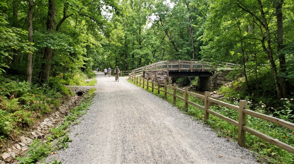
From an engineering and construction perspective, the Tweetsie Trail is a masterclass in linear park design. The trail spans roughly ten miles one way, providing twenty miles of continuous round-trip travel for those looking for an extended workout. Because it was engineered originally for heavy freight trains, the elevation changes are remarkably gentle. The railroad could never climb steep slopes, so the trail follows an easy, gradual grade that rarely exceeds two percent.
The surface of the Tweetsie Trail is composed of finely crushed limestone and compacted stone dust. Unlike hard asphalt or concrete, this packed crushed-stone surface absorbs impact, making it far easier on knees, ankles, and joints. Runners who train for marathons frequently choose the Tweetsie Trail because the surface reduces muscle fatigue and joint strain. At the same time, the surface is packed firm enough to easily support double jogging strollers, road bikes with sturdy tires, and standard hybrid bicycles.
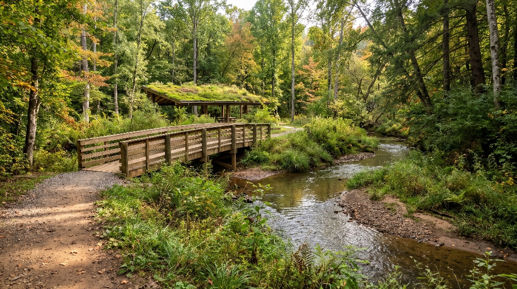
Water management along the Tweetsie Trail is equally impressive. Proper grading, drainage ditches, and culverts keep the path stable even after heavy Appalachian rains. Seven historic wooden bridges and converted railway trestles carry users across bubbling creeks and low gullies. These bridges not only serve a practical purpose by keeping users out of mud and flood zones, but they also provide scenic focal points for photographs and family memories.
Tweetsie Trail Quick Facts
----------------------------------------------------------------------
Total Linear Length:       Approximately 10.0 miles (20 miles round-trip)
Surface Material:          Compacted crushed limestone / stone dust
Average Grade:             Less than 2% continuous railroad slope
Counties Connected:        Washington County and Carter County
Active Bridges:            7 converted historic railroad trestles
Permitted Uses:            Walking, running, hiking, non-motorized cycling, Class 1 e-bikes
Operating Hours:           Dawn to dusk, 365 days a year
Trailhead Locations, Access Points, and Parking
One of the great advantages of the Tweetsie Trail is how easily you can access it from multiple points across Johnson City and Elizabethton. You do not have to tackle all ten miles at once. You can easily plan your outing based on your fitness level, available time, or where you want to stop for coffee afterward.
Alabama Street and Van Brocklin Way Trailhead (Mile 0.0)
The western terminus of the Tweetsie Trail begins at 116 Van Brocklin Way, right at the intersection of Alabama Street and Legion Street in Johnson City. This is the primary launching area, featuring a large paved parking lot, public restrooms, picnic tables, water fountains, and a bicycle repair stand equipped with tools and an air pump. If the main parking lot fills up on busy spring weekends, overflow parking is readily available just down the road near the Memorial Park Community Center.
Quarry Overlook (Mile 3.0)
As you travel east, you will reach the Quarry Overlook near the three-mile marker. This rest area offers a portable restroom, bench seating, and views down into an active limestone quarry. It is a popular turnaround spot for local runners who want a clean, six-mile out-and-back route starting from the Johnson City trailhead.
Happy Valley and Milligan Highway Access (Mile 3.1)
Located just past the Quarry Overlook, this access point sits on Happy Valley Road directly across from Happy Valley Elementary School. While parking here is limited compared to the main hubs, it serves as an entrance for residents living in the Milligan and Happy Valley communities. It allows families to hop on the Tweetsie Trail without having to drive into downtown Johnson City.
Elizabethton Little League Ballfields (Mile 4.2)
Situated near 1808 West Elk Avenue in Elizabethton, this midpoint access area provides ample parking near the municipal ballfields. Entering the Tweetsie Trail here puts you right in the middle of the corridor. From this point, you can choose to head west into the scenic woodland canopies or head east toward the downtown shops of Carter County.
Elizabethton Terminus at Stateline Road (Mile 9.4 to 10.0)
The eastern end of the Tweetsie Trail concludes at the intersection of Stateline Road, Blue Ridge Drive, and Hatcher Lane. A designated parking lot and portable restroom sit near the 9.4-mile marker, making it easy to stage a two-car shuttle or begin your journey from the Elizabethton side. Starting here allows you to enjoy a quiet, rural ride westward into Johnson City.
| Trailhead / Access Point | Mile Marker | Key Amenities | Best For |
| Van Brocklin Way / Alabama St | Mile 0.0 | Paved parking, restrooms, water, bike tools | Full-service launching, groups, rentals |
| Quarry Overlook | Mile 3.0 | Scenic overlook, benches, portable restroom | Quick turnaround, interval workouts |
| Happy Valley Road | Mile 3.1 | Neighborhood parking, school zone access | Milligan area residents, quick dog walks |
| Elizabethton Little League | Mile 4.2 | Ballfield parking, wide open staging | Mid-trail start, exploring either direction |
| Stateline Road / Blue Ridge Dr | Mile 9.4 to 10.0 | Dedicated parking lot, portable restroom | Carter County starts, quiet morning walks |
Section-by-Section Trail Experience
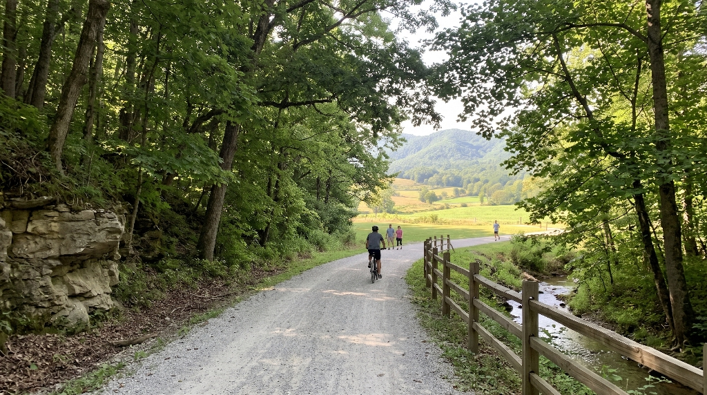
The character of the Tweetsie Trail changes dramatically across its ten-mile path, giving users three distinct environments to explore.
Miles 0 to 4: The Scenic Mountain Cut and Shaded Canopy
Leaving the Alabama Street trailhead in Johnson City, the Tweetsie Trail immediately enters a tranquil green world. For the first four miles, towering hardwoods form an arching canopy overhead. This section passes through deep rock cuts where railroad workers blasted straight through solid limestone ridges over a century ago.
Because of the dense tree cover and stone walls, this stretch remains five to ten degrees cooler than open city streets during hot summer days. The sound of nearby Sinking Creek accompanies your footsteps, and native wildflowers bloom along the timber embankments throughout spring. This is widely considered the most picturesque stretch of the Tweetsie Trail and is a favorite for local photography, weekend dog walks, and peaceful morning jogs.
Miles 4 to 7: Rolling Farmland and Historical Transitions
As you move past the fourth mile marker, the deep woods open up into expansive views of the Carter County countryside. Here, the Tweetsie Trail winds alongside rolling pastures, historic farmsteads, and open meadows framed by the distant peaks of the Appalachian Mountains.
This middle section crosses several wooden trestle bridges that offer clear views of cascading creek waters. You will also pass near the historic Milligan community and spurs that connect outward toward Sycamore Shoals State Historic Park. The open sky in this section allows for warm sunlight, making it an ideal route for brisk autumn afternoons when the fall foliage paints the surrounding ridges in brilliant amber and crimson.
Miles 7 to 10: Town Approach and Elizabethton Heritage
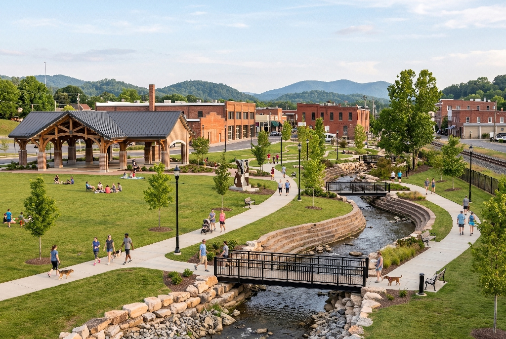
The final three miles transition into a more urbanized, historic town setting as the Tweetsie Trail enters Elizabethton. The path skirts active community centers, local parks, and commercial districts. You will encounter street crossings equipped with pedestrian signals and warning beacons.
This section offers convenience for long-distance trail travelers. It allows cyclists to exit the path easily to grab lunch, visit local bakeries, or explore downtown Elizabethton. The trail finishes quietly at Stateline Road, leaving you with a deep appreciation for how seamlessly our regional history has been woven into everyday modern recreation.
To ensure the Tweetsie Trail remains safe, peaceful, and welcoming for everyone, both Johnson City and Carter County have established clear guidelines for visitors. Understanding these common-sense rules keeps the trail enjoyable for all users.
- Hours of Use: The Tweetsie Trail is open daily from dawn until dusk. Because there is no artificial lighting along the corridor, users must exit the trail before darkness settles for their personal safety.
- Pet Guidelines: Dogs are welcome on the Tweetsie Trail, but they must be kept on a standard, non-retractable leash no longer than six feet at all times. Owners are legally required to clean up after their pets. Waste bag stations and trash cans are located at major access points.
- Right-of-Way Etiquette: The trail operates on a simple hierarchy. Pedestrians, runners, and mobility assistance devices always have the right of way over bicycles. Cyclists must maintain safe, controlled speeds and yield to all foot traffic.
- Audible Passing Warnings: When approaching other users from behind, cyclists and fast runners should ring a bell or clearly announce their presence with a friendly phrase like “passing on your left.” Never pass silently at high speed, especially around small children or leashed pets.
- Motorized Vehicle Prohibitions: All gas-powered vehicles, motorcycles, dirt bikes, and all-terrain vehicles are strictly banned from the Tweetsie Trail. Traditional human-powered bicycles and Class 1 pedal-assist electric bicycles are welcome. Electric devices must adhere to posted twenty-mile-per-hour speed limits.
Surrounding Neighborhoods and Residential Appeal
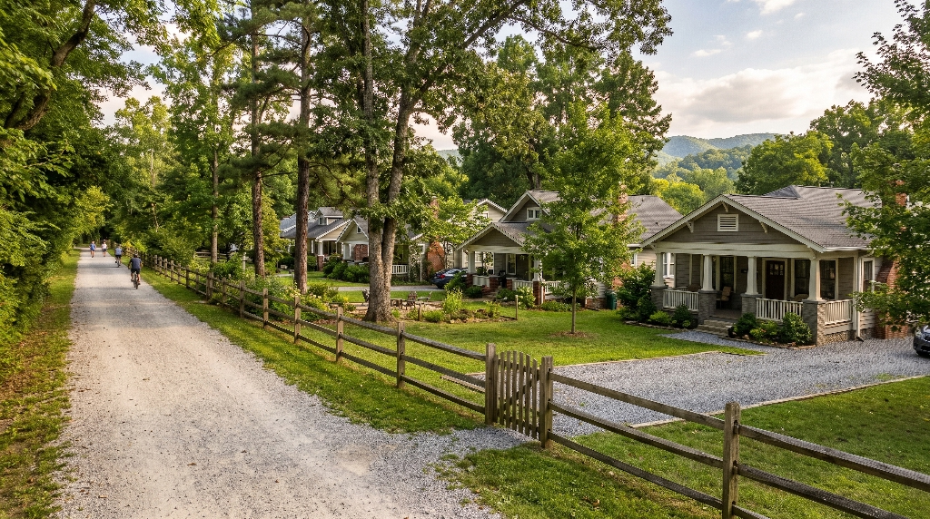
Public greenways are not just recreational paths, they are powerful anchors for neighborhood value and long-term livability. The Tweetsie Trail has transformed real estate demand in Southeast Johnson City and Western Carter County over the past decade.
Proximity to outdoor recreation is consistently ranked as a top priority for homebuyers, especially among relocating families, active retirees, and medical professionals working at the nearby Johnson City Medical Center or ETSU Quillen College of Medicine. Homes situated within walking or biking distance of the Alabama Street trailhead command healthy premiums. Properties along Legion Street, Tree Streets extensions, and South Roan corridors enjoy immediate trail access without having to pack bicycles into a car rack.
From a structural home design perspective, having the Tweetsie Trail nearby changes how people live inside their houses. We see growing homeowner demand for dedicated mudrooms with built-in dog washing stations, oversized two-car garages with ceiling-mounted bike hoists, and covered rear porches designed for unwinding after a morning run. Active families want homes that support an outdoor lifestyle. The quiet streets surrounding the Tweetsie Trail provide safe, established neighborhoods with mature trees, generous lot sizes, and a timeless community feel.
Living near the Tweetsie Trail also encourages daily wellness habits. Instead of having to drive to a gym or run on a loud motorized treadmill, homeowners simply step outside, walk two blocks, and find themselves immersed in a serene forest canopy. That level of lifestyle integration makes neighborhoods near the Tweetsie Trail among the most desirable and stable investments in the entire Tri-Cities housing market.
Frequently Asked Questions About the Tweetsie Trail
How long is the Tweetsie Trail in Johnson City, TN?
The Tweetsie Trail is roughly ten miles long in total length. An out-and-back journey from the Johnson City trailhead to the Elizabethton terminus and back covers a complete distance of twenty miles.
Where does the Tweetsie Trail start and end?
The western start of the Tweetsie Trail begins at 116 Van Brocklin Way near Alabama Street and Legion Street in Johnson City. The eastern end finishes at the intersection of Stateline Road and Hatcher Lane in Elizabethton.
What is the surface of the Tweetsie Trail?
The surface of the Tweetsie Trail consists of compacted stone dust and finely crushed limestone. It provides a smooth, firm, and natural pathway that cushions footsteps while remaining firm enough for strollers and bicycles.
Are dogs and electric bikes allowed on the Tweetsie Trail?
Yes, dogs are permitted on the Tweetsie Trail, provided they remain on a six-foot leash and owners pick up their waste. Class 1 pedal-assist electric bicycles are also allowed, but all gas-powered motors and all-terrain vehicles are prohibited.
Where can you park for the Tweetsie Trail?
Primary parking is located at the Alabama Street trailhead in Johnson City and at Stateline Road in Elizabethton. Additional public parking is available at the Happy Valley Road lot and the Elizabethton Little League ballfields.
Is the Tweetsie Trail paved?
No, the Tweetsie Trail is not paved with asphalt or concrete. It features a finely crushed limestone surface that provides natural water drainage and superior shock absorption for walking and running.